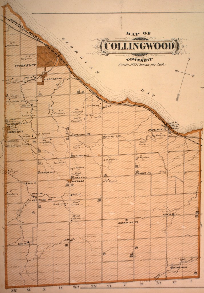
In the Town of Blue Mountains, ON there is a small hamlet called Craigleith. Originally, it was called Shaleville and was in the Township of Alta. In ca. 1836, its first settler arrived – John Brazier and his wife Elizabeth along with their five children. They arrived from West Gwillimbury after the road going along the shore of Georgian Bay was cleared from Wasaga Beach to the Bighead River. This road now is called Hwy #26. The St. Vincent Trail, over which the mail was carried from Duntroon to Vail’s Point (which was originally known as Point William )(Meaford), joined the shore road at Brazier’s farm. These roads were once native trails traveled by resident Betan Nation, (anglicized Petuns), the Jesuit missionaries and early traders like Samuel de Champlain in the late 1500s – mid 1600s. The Anishinabek Nation have occupied this Land since time immemorial.
The farm had a beautiful view of Georgian Bay. Brazier built his log cabin in a sheltered valley of Mill Creek, about a third of a mile inland, on a path that curved upward from the shore along the creek, later known as “Brazier’s Road”. These two squared logs are all that remain of the first log cabin, and soon, they will deteriorate and our first settler’s home will be but a distant memory. Adjacent to the Brazier site are the two Petun Village sites that existed there in the 1600s. No trees grow on the land, just vegetation. I wonder if the Braziers knew their former neighbors were the Petuns and if they found many artifacts as they plowed their land. No doubt they did!
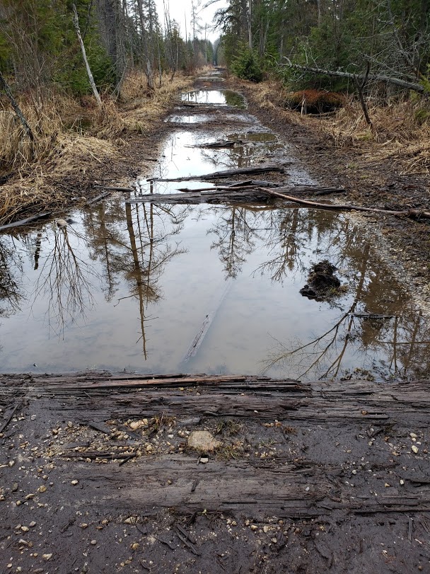
Every corduroy road leads somewhere: This past Tuesday, I walked an early settlement corduroy road that my late dear friend Clive drew a map of from his memory and sent to me. His grandpa told him that at one time it was the only road between Duncan and Flesherton, and that it was an ox cart narrow passage through a swamp in Osprey Township. Just up from the old road is a vintage car on a hill in Rob Roy Village. The village is named for Rob Roy McGreggor (1671- 1734), a highland chief known as the Scottish Robin Hood, who was known as either a hero or an outlaw, depending upon your own clan loyalties. The first Rob Roy School, built in 1881, burned under mysterious circumstances in the spring of 1889. Student delight was short-lived, as school quickly reconvened in Thomas Freethy’s hot blacksmith shop which meant sitting on backless benches until the present building was completed in the fall of the same year. The Schoolhouse is the most architecturally-detailed schoolhouse in Ontario and is now the Osprey Museum, located at the end of Pretty River Valley Road. I love the hidden pioneer roads in the forests of the Niagara Escarpment. Where they lead, one just never knows. Signing off, “Hiking with the Viking”.
This Viking and Ojibwe friend hiked the Land of the Anishinaabeg people on the Niagara Escarpment. This place is now referred to as the Petun Conservation Area in the Town of Blue Mountains.
We stood together on the ancient rock where his ancestors once stood and looked out across the Land and Water since time immemorial of what is now Clearview Township and Georgian Bay.
It was here that they kept watch over their people, hunting grounds, and the Betan (Beh-ton), anglicized as Petun, Villages below that went from Craigleith to Creemore. The Betan were here from the late 1500s to mid 1600s, over a period of 70 years.
I was told the Anishinaabe oral history of when the enemy were sighted, fires were lit across the edge of Escarpment up to Manitoulin Island. When seen, his people would come together in the strength of numbers from all directions.
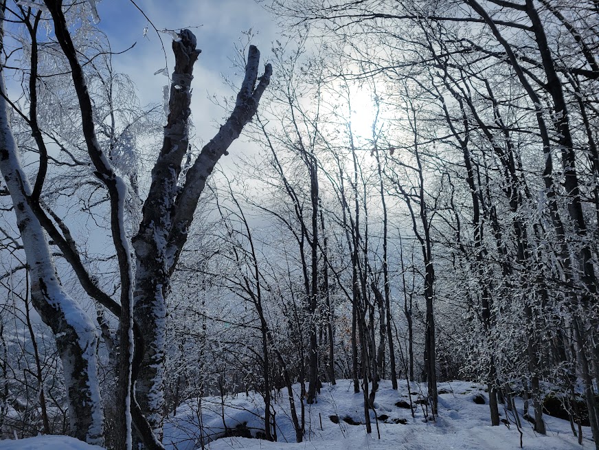
Along the trail, the forest glistened with incredible ice beauty as we shared our knowledge of the land and inhabitants and how they provide for us.
There was a moment (one of several) of great Mnidoo (Spirit) when the place where we two friends stood was presented with a light like I have never seen before and one that I will forever remember. All around us, the ice released from the trees like frozen rain.
“Tell me and I forget. Teach me and I remember. Involve me and I learn”
Benjamin Franklin
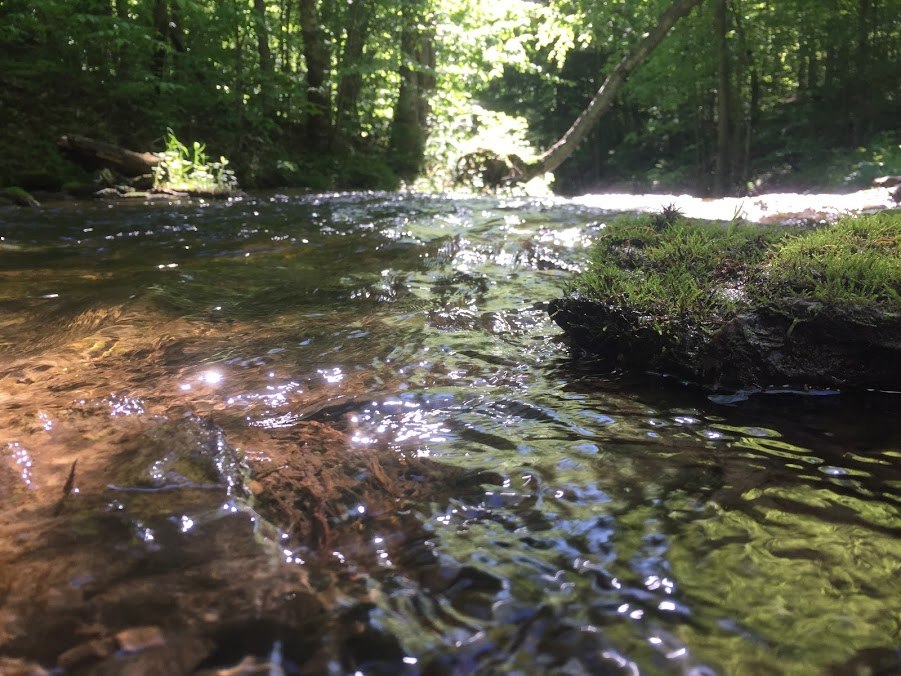
There is something very special about the relationship between children and nature. If given the freedom to connect, they do so in a very gentle and unspoken way which is very natural to them. It triggers a wonderment of how every life form exists on its own, and how it also lives as an integral part of the forest. This, in turn, begins to form a desire to investigate and solve the questions of why and how it all works to create this magical place to be. When they are involved in experiences with nature, you can see children of all ages fully immerse themselves in their surrounding environments and live in the moment, an art that gets lost in the busyness of daily routines and responsibilities. They want to be there, and they honestly are amazed at the grasshoppers jumping and flying along the warm path in front of them, and at the sparkle of the creek when the sun meets the rippling water. The exposure to nature can be in the playground, going for a walk, or hiking the Bruce Trail in the woods of the beautiful and ancient land of the Niagara Escarpment.
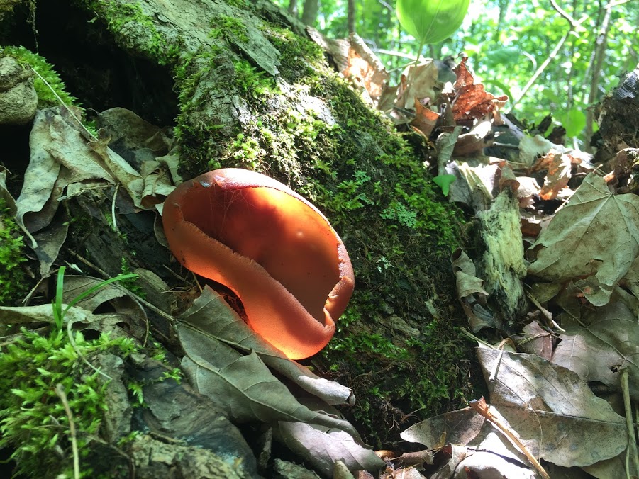
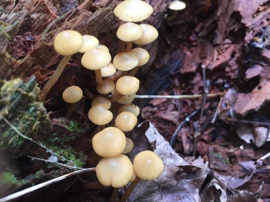
It is in these places that we experience the diversities found in nature – from colorful and strange fungi to layers of rock formed hundreds of millions of years ago that hold the fossils of life-forms of that time. All of it teaches children to love and appreciate this beautiful world around them and to understand their own relationship with it. By encouraging and allowing children to connect with their surroundings, we’re supporting their love and appreciation for all living things. We don’t often see many animals while hiking so we are more exposed to plants, insects, birds, and smaller mammals like the squirrel and beaver. We can learn so much by paying attention to how children seek them out. A toddler can learn the name of the trout lily and call out to the plant and ask where they are hiding. When found, it is an opportunity for us to show them how to be gentle towards the beautiful nodding yellow flowers with the brown speckled leaves. Year after year, they will ask the name of it until one day in May, they show us where the colony of Trout Lilies are living, and make caution not to step on it. They are listening, they are learning, and they are connecting. I have watched an eight year old boy carefully let a spider travel on his arm while hiking the trail. I could see the pride he felt with his sense of caring for the arachnid and I could also see that he felt responsible for the spider’s trust in him. He was so careful not to drop it or hurt it in any way. When the spider was ready to return to the ground, the boy released it with good spirits. It is incredible to witness such a friendship between a boy and a spider being expressed through the language of the forest. It is up to us to take them there and give them the space to build relationships with the land. They will ask us questions and in their quiet they will ponder more deeply than what we can know.
Nature also provides so many opportunities to learn about how we can behave in our own lives. When hearing the call of a turkey vulture, we will teach the children the importance of the bird’s ecology role as savagers, soaring high and picking up carnegie, thus preventing the spread of disease. But we can also learn that we can see things from a different perspective than others. Such as the turkey vulture’s view-point high in the sky, to the snake burrowing below the ground getting ready for the cold winter to start, and that’s it’s all important and deserving of respect. Nature shows us that by allowing each other to do so, we are all a critical part in the circle of life.
The bees, rain, frogs, spider webs, pine cones, and salamanders, are just a few inhabitants that provide an endless supply of wonder for play and creativity for children, so let them spend time with forest life. Afterall, the forest doesn’t come with instructions. We all will learn through our curiosity and when we understand, we begin to love what we didn’t know before – nature and nurture are two words that belong together.
We protect what we love. Let’s kindle a child’s love for nature as early as we can.
Have you ever thought of walking through the land of Merlin where magic comes alive with every step you take? A place where, as you walk through the forests, the stories of the people who once lived there come alive through ruins, old farm machinery, and cars left behind long ago, and the only limitation of traveling back in time is your own imagination.
We usually think of Merlin as a legendary Wizard featured in many historical and mythological books and movies alongside KingArthur and the Knights of the Round Table, but it was also the name of a former Township of Simcoe County in 1832. Originally, the northern shore part of the township where Collingwood and Wasaga Beach are now, was called Java and the southern part dividing at Duntroon was Merlin. In the same year, after being surveyed first by Thomas Kelly and then by Charles Rankin, it was decided that the two small townships would amalgamate into one and be named Nottawasaga.
“Nottawasaga” Naadwe Saagiieh (Nawd -whe-saw-*gee-eh) is Anishinaabemowin (The Ojibwe Language). It can translate as “Where the enemy comes from,” but the phrase is much harsher than that. Naadwe is a pejorative and an insult to the Iroquois.
The land that was being used for Ojibwa hunting and gathering expeditions would soon have immigrants traveling from Scotland (Duntroon) , Ireland (fourth concession/Fairgrounds rd), and Germany (near Batteau) in hopes of settling into a new and improved life . In Merlin, Thomas Kelly writes that he found two beaver meadows, an old fort and two extinct volcanoes in the sedimentary rocks of the Niagara Escarpment, but he never finished the survey. Apparently his alcohol drink became problematic in his work, so in 1833, Charles Rankin was sent to complete the survey. Was Thomas Kelly drunk when he noted these unusual and wondrous discoveries, or did he see some magic that others couldn’t? Nonetheless, the people came with their own stories and legends of their far away homeland and wrote of new tales of adventure of this beautiful and wild land of Upper Canada. Today, the towns of Collingwood and Wasaga Beach are independent municipalities and Nottawasaga Township amalgamated with Sunnidale Township to form the municipality of Clearview in 1994. There is so much history, beauty and yes, the magic of nature to be found hiking on the trails of the Niagara Escarpment, and who knows, maybe you’ll even run into a Wizard in the Land of Merlin.
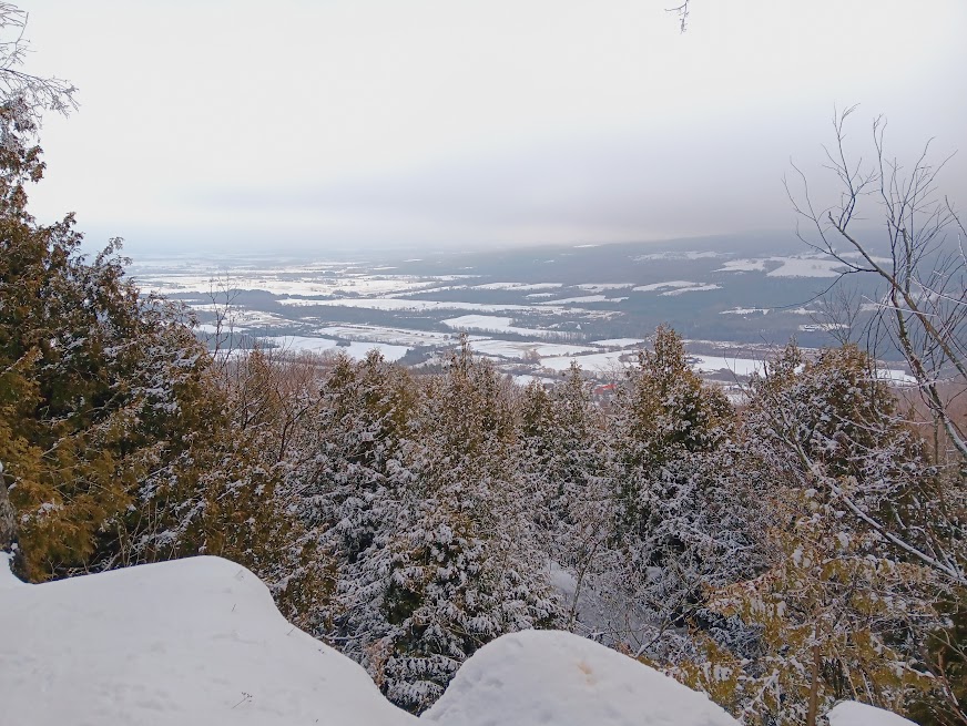
Hikers can view Clearview Township from the top of the Niagara Escarpment via the Bruce Trail map #23, from the Petun Conservation Area, the Pretty River Valley Provincial Park and the Nottawasaga Lookout Provincial Nature Reserve. Visit the Bruce Trail Conservancy web-site to order the 2020 Map and Trail Guide, or just individual maps. https://brucetrail.org/trail-sections/4
For scheduled group hikes, go to the Blue Mountain Bruce Trail Club website http://www.bmbtc.org/
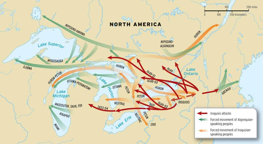
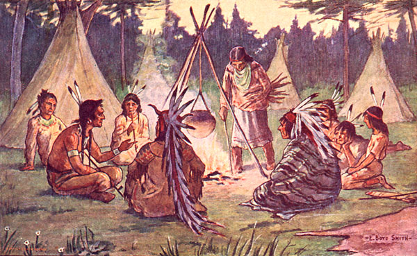
The woody valleys of the Blue Mountains, from Craigleith to Creemore ON, were occupied historically by the several Iroquoian nations that were collectively nicknamed “Petun” by the French, meaning Tobacco, because they were known for their usage of tobacco, or petún, more so than their cultivation of it. The people called themselves the Betan (Bay-ton), and they were called Tionontati by their cousins to the NE, meaning “People Among the Hills/Mountains.”
They were divided by the two different Petun Clans – the Deer and the Wolf, who were present for only about 70 years (ca. AD 1580–1650) but left abundant evidence of their presence. The Wolf arrived first (ca. 1575/80 A.D) surrounding the Pretty River Valley area and the Deer arrived later (ca. 1600,) in the Craigleith area. At both locations, archeologists unveiled that at any one time, there was one principal larger village followed by a smaller one with a distance anywhere between a half to three kilometers between them. During their time here, they were visited by many groups, one being Samuel de Champlain in 1616, on his journey to find easy passage to China and then the Jesuit Priests, 1639-1650, who would set up missions in nine of the Villages to convert the Betan to Christianity.
According to the research of Charles Garrad, one of many of the original native trails ran east of the two major Petun villages at Craigleith. The trail followed the prominent Lake Nipissing beach ridge through the Blue Mountain Golf Course west of Collingwood, parallel and just south of Campbell Street; it continued across the Pretty River, through the Roman Catholic and the higher part of the Anglican cemeteries on the east side of Raglan Street, and continued easterly to the Nottawasaga River Crossing. Along this part of the trail, artifacts, burials, and campsites of various ages have been found, particularly at stream crossings. Archaeological research in the Betan Country also revealed that there were additional villages, such as the one discovered at OslerBrook Golf and Country Club. On the grounds lie the remains of a Betan (Petun) Ossuary (burial ground) and Village dating back to the days of Champlain. A cairn has been erected in its honour.
In December 1649, during the Beaver Wars, the Iroquois attacked the Petun village of Etharita near Duntroon, causing the dispersal of the Betan and leaving the Iroquois on the Odawa hunting territory. As you hike along the Bruce Trail of Blue Mountain, the Petun Conservation Area, and the Pretty River Valley, look across the land below and give a moment of your thoughts to the incredible history of the Indigenous people that were here long before we walked this land, and its virtually unchanged beauty.
Before the invention of modern concrete, travellers were able to cross muddy, swampy grounds by building “corduroy roads”—paths that were constructed of logs laid perpendicular to the direction of the route.
Canada’s first travel routes were the rivers and lakes used by Indigenous people, travelling by canoe in summer and following the frozen waterways in winter. The water network was so practical that explorers, settlers and soldiers followed the example of the Indigenous people. The first graded road in Canada was built in 1606 by Samuel de Champlain and was 16 km long stretching from Port Royal to Digby Cape, Nova Scotia. In 1793, an Act of the first Parliament of Upper Canada placed all roads under the supervision of overseers, called path masters. Early road development was accomplished by a system of “statutory labour,” which required settlers to maintain the road adjacent to their property or to work 3 to 12 days each year on road maintenance. Over time, the statutory labour system was commuted into payment of a fine in lieu of labour, creating the first source of funds for road expenditures.
In Simcoe/Grey County, many of the early pioneer roads can still be found as shown below. Sometimes, they’re easy to see and other times a bit of research gets you there!
When I see the storms coming in from Georgian Bay like today, I am reminded of the thousands of shipwrecks that lie on the bottom of it. How horrifying it must have been to be aboard a distraught ship, especially in the freezing waters of November. Here’s the story of Georgian Bay’s first shipwreck. Nov. 4, 1828
When Drummond Island was evacuated in 1828, the Government sent the schooner SS Alice Hackett to do the job of transporting the remaining 25 island residents south to Penetanguishene, including an innkeeper named Fraser with his thirteen barrels of whiskey, and William Solomon, a government interpreter.
Solomon arranged for his possessions to be part of the voyage – two horses, four cows, twelve sheep, and eight pigs, and they all set sail. This turned into Georgian Bay’s first shipwreck after they hit a sand bar at Fitzwilliam Island, near Manitoulin Island. A storm and the inebriated condition of the crew from Fraser’s fine spirits are reported to be the cause of the ship going off course.
Miraculously, all 25 passengers survived the wreck along with some pigs, the thirteen barrels of whiskey, and Solomon’s white prize horse named ‘Louie’.
They managed to take refuge on the shores of Fitzwilliam Island and after 3 days, all were saved and arrived safely in Penetanguishene. All, except for Louie, that Solomon tried in vain to have taken off the island but to no avail. Louie could be seen by boats for years later running on the Island. He would end up dying there which, since then, has become known as (Ghost) Horse Island.
When you hear the howling of the storm, think of the ones who went down listening to that as the very last sound they would ever hear.
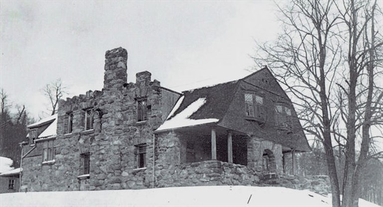
In the mid 1800’s, an enchanting love story between Britton Bath Osler and his wife Caroline began, and that brought them to County road 19 in Grey County, at Castle Glen Estates. Britton was a famous Canadian criminal lawyer, and also the crown attorney at the trial of Louis Riel on the charges of treason in 1885. He founded the law firm of Osler, Hoskin & Harcourt in Toronto. When his wife, Caroline, began to suffer from her chronic arthritis, Osler decided in 1893, to build the 15-room Osler ‘Castle’ near the Town of Blue Mountain. Mr. Osler hoped that the ‘fresh air’ would improve her health. Before he was finished, several hundred thousand dollars had been invested. The “cottage” that emerged from the construction had 15 rooms within a stone shell of huge granite-hard heads that had been gathered from the surrounding hills. It was a fanciful structure of massive cut rock with turret-like chimneys, an arched entryway, and large bright windows. It was built to last an eternity. Tragically, Caroline died before ever being able to summer at Osler Castle. She died on May 3, 1895. After Caroline’s death, Britton visited the home for 5 years before his own health deteriorated. After his death in 1901, the Butler and Maid remained in the house for years, until they left to live an easier life in Collingwood. Left unattended, the empty home became the target of lawbreakers. The furnishings were stolen and the home vandalized and eventually set on fire. Of course, urban legends began to sprout up with notions that the castle was haunted and that strange lights could be seen and horrible noises heard. Today, all that’s left of the castle are ruins which keep watch over the Lake in the Clouds and is lined by the Silver Creek flowing down the Escarpment. You can access it several ways, one of the most beautiful is by way of Silver Creek.
There is a gallery of beauty, so intricate and precise, where every stroke of the brush creates a canvas of energy and color. It is a privilege to step inside the frame and share in it’s magnificence. Presenting some of the sites of the Magic of Nature, as seen through my eyes. “Hiking with the Viking”
The Anishinaabe also have an extensive history in this area from time immemorial. In the late 1500s – 1650s, they shared the Land running alongside the Niagara Escarpment with the Betan (also known as the Tionontati and Petun) who are an Iroquoian-speaking Indigenous people, closely related to the Huron-Wendat. They lived in many Villages from Craigleith to Creemore for approximate 70 years until they were chased out of their homeland by the Iroquois in the mid-1600s during the Beaver Wars. According to Peter S. Schmalz’s ‘The Ojibwa of Southern Ontario’, the Battle of the Blue Mountains took place in Clearview Township at a former Betan Village location. March 16th, 1696 marks the anniversary date of this battle between the Anishinaabe and the Haudenosaunee Warriors. At sunrise, the Iroquois were surrounded and attacked by the Ojibway. Many Iroquois were killed, but some managed to escape. Others were captured and made to watch as the hundreds of dead were decapitated and the heads stuck on poles that stood along the edge of what would become the ski hills of the Blue Mountains, facing north, toward the land of the Ojibway. The survivors were told to go home and tell of what they saw. To hike here, go to Blue Mountain Section, Bruce Trail Club, Map #23
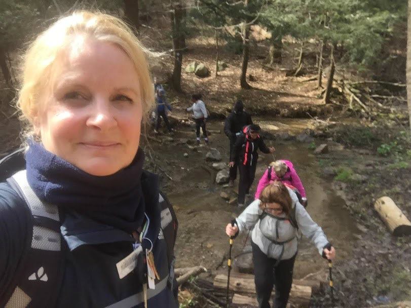
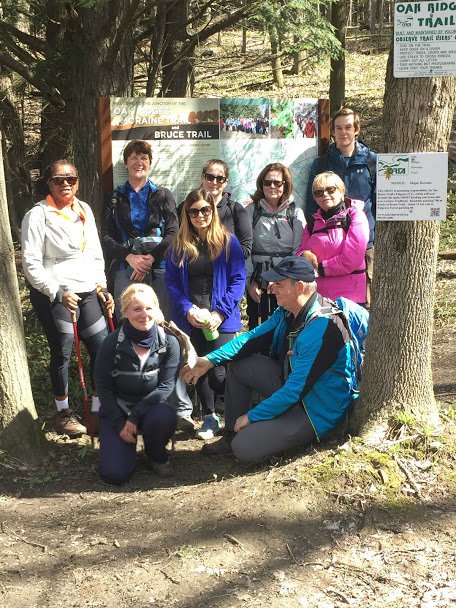
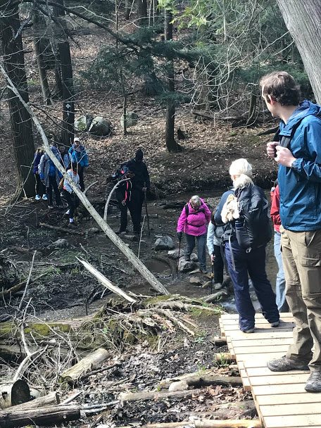
In this series of Caledon Hills Bruce Trail Club Hiking badges, I am leading a hike of 16 participants, in a series of five, throughout the Caledon Area for the Caledon Bruce Trail Club. Upon completion of these hikes, you are awarded an “Historical Hike” badge for your collection. This 11 km hike was in the Glen Haffy Conservation Area, which hosts VERY serene mature forests. Located at the crossroads of the Niagara Escarpment and the Oak Ridges Moraine, the terrain is very up and down, but the ups provide some spectacular views. Overall, if you want a work-out in an area that makes you forget (sort of) the strain, this is a totally great hike. Signing off “Hiking with the Viking”. Bruce Trail Caledon Hills Map #17 Glen Haffy